A five-lot subdivision of land that separates Wonga Park from Chirnside Park has been approved by the Victorian Civil and Administrative Tribunal (VCAT) despite objections from the council and residents.
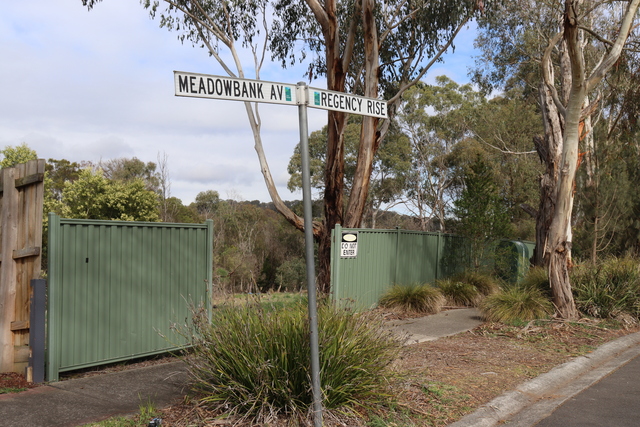
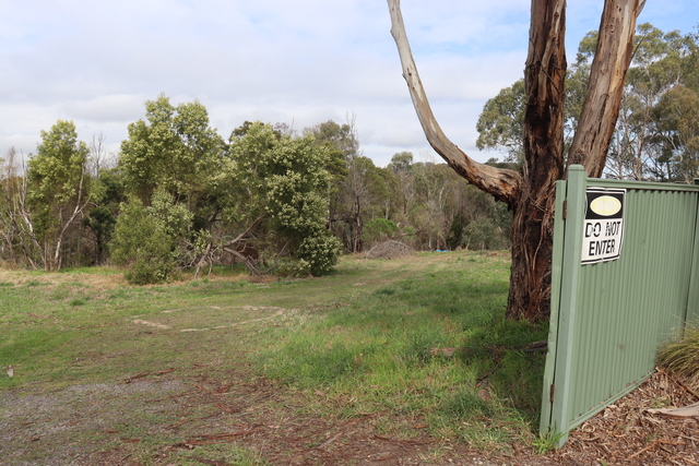
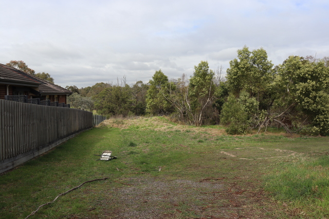
The land in question sits at the juncture of Holloway Road Wonga Park, and Regency Rise Chirnside Park, behind Oxley Christian College, with the Brushy Creek running through it.
Lot sizes proposed by the applicant, Ashlyn Springs, range from one hectare to three hectares, with a court bowl and crossover proposed for access to the lots from Regency Rise.
Yarra Ranges Council refused the permit application in August 2024 due to the loss of native vegetation and its impact on biodiversity values.
Another central objection from the council, as well as two complainants, Stanislaw Dziadosz and Thomas Hewitt, was the risk of flooding, which they viewed as being inadequately addressed in the plans under the land subject to inundation overlay (LSIO).
Melbourne Water did not oppose the proposal with respect to flooding impacts.
Ultimately, VCAT senior member Ian Potts and member Joel Templar decided “the subdivision is an acceptable planning outcome” and granted a permit with multiple conditions.
The members noted the uniqueness of the land, situated “on the outskirts of a typical suburban area, positioned between two established residential neighbourhoods” but holding a rural living zone (RLZ) classification.
Mr Hewitt opposed the subdivision primarily because of the vegetation removal, but also because of the erosion of the low-density character of the area, environmental impacts like water pollution and suggested the council should purchase the land as open public space.
Mr Dziadosz agreed with Mr Hewitt but also added concerns regarding the release of dangerous gases from the nearby wastewater treatment plant from ground disturbance, the closeness of building envelopes to his property and the resulting noise, that the proposal is situated in a fire break and the lack of consultation with neighbours.
Members Potts and Templar said that while the issue of vegetation removal was acceptable, the “other issues raised are either not of sufficient concern to warrant rejection of the proposal or are outside the Tribunal’s scope”.
On the topic of vegetation removal, the members recognised that since 2018, six assessments by Nature Advisory and Ecology and Heritage Partners, environmental consultants, had taken place, the most recent being in April 2025.
With a reduction in the intensity of the subdivision development in the assessed iteration of plans, it was estimated that there would be a possible loss of 1.795 hectares of native vegetation across the total 7.811 hectares, mostly contained in the north-east corner.
Ashlyn Springs argued that while, yes, there would be impacts on native vegetation, the riparian zone of the Brushy Creek would be retained and managed, “with an expected improvement in the native vegetation conditions and habitat value”.
In their reasoning, the Tribunal members also cited that the assessments from Nature Advisory and Ecology and Heritage Partners were closely aligned on one fact.
“Notwithstanding the differences, the collective outcomes of the assessment are that both identify the native vegetation present on the subject land to be in poor condition. This is largely due to the presence of high-threat weeds in the lower and ground storeys.
“In addition, the patches of native vegetation do not support any significant floral or faunal species on the State or Commonwealth lists for endangered or threatened species.”
The council argued that a reconfiguration of the lots could further minimise native vegetation losses but the Tribunal refuted this, stating “the proposal strikes an acceptable balance”.
“We also acknowledge that the degree of habitat loss arises from developing this land for future residential use in a (bushfire prone area).
“This, however, is also a consequence of zoning the land for rural living purposes, with management of bushfire defendable space being an inevitable consequence of any development consistent with this purpose.”
Ashlyn Springs acknowledged that a land management plan (LMP) was a “significant factor in favour of approval of a permit” and compliance of an LMP would “ultimately lead to a net gain to biodiversity in Victoria”.
The LMP requires broad actions including: management of vegetation in appropriate condition; installation and management of wildlife-friendly fencing; removal and control of weed species; pest animal control; rubbish removal; revegetation of the two Conservation Zones with appropriate species from the applicable ecological vegetation classes.
A permit condition also requires fencing to clearly mark the boundaries of the conservation zones, the domestic zone and the open space zone.
Members Potts and Templar also applied a minimum five-meter setback for the building envelope of Lot 1; a cash payment equivalent to five per cent of the land’s site value must be paid to the responsible authority in lieu of providing public open space; and a qualified wildlife handler or zoologist must conduct a pre-clearance survey to ensure that no animals are harmed.
Conditions regarding the construction of roads, vehicle crossings, footpaths, and stormwater drainage were also applied.